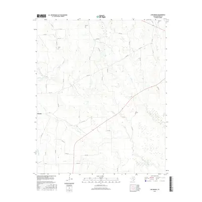
2016 Map of Line Branch
USGS Topo · Published 2016About this map
Fulbright stands as the primary community in this rural section of Red River County, situated at the intersection of several farm-to-market roads. The landscape is defined by a dense network of watercourses, including the south-flowing Cuthand Cr and Scatter Cr, which drain the open country between scattered agricultural holdings. A legacy of local settlement is evident in the distribution of family and community burial grounds, such as Thompson Cem and Catonville Cem, which anchor the histories of the surrounding farmsteads. Smaller water bodies like Deanborn Lake and Jan-kay Lake provide focal points within the drainage basins of Liberty Cr and Gouchy Cr. The infrastructure of the area is primarily composed of county roads that follow the rise and fall of the terrain, connecting isolated homesteads and the various branches and creeks that feed into the larger regional watershed.
Find a feature on this map
52 named features on this map. Tap any name to fly to it.
Don’t see what you’re looking for? This feature index may not catch every label — zoom into the map to look around manually.
Map Details
Editions of this 2016 Line Branch Map
This is the sole edition of this map. No revisions or reprints were ever made.
Other maps of this area

1953 · Texarkana
USGS Topo · 1:250,000

1956 · Texarkana
USGS Topo · 1:250,000

1963 · Cunningham
USGS Topo · 1:24,000

1964 · Detroit
USGS Topo · 1:24,000

1964 · Deport
USGS Topo · 1:24,000

1964 · Bagwell
USGS Topo · 1:24,000

1964 · Cuthand
USGS Topo · 1:24,000

1964 · Bogata
USGS Topo · 1:24,000
1964 · Dimple
USGS Topo · 1:24,000
1964 · Line Branch
USGS Topo · 1:24,000