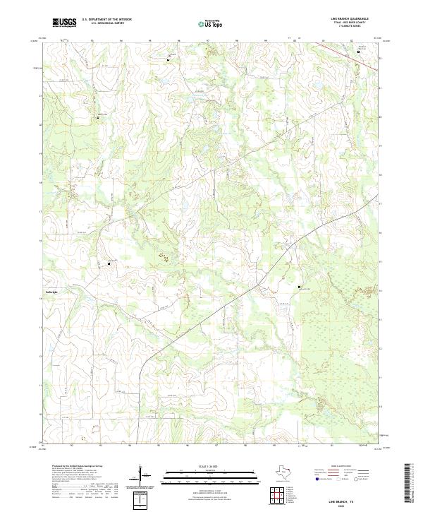
2022 Map of Line Branch
USGS Topo · Published 2022About this map
Fulbright serves as the primary community anchor in this portion of Red River County, situated where FM 411 intersects a network of local roads. The landscape is defined by its intricate drainage patterns, with numerous small waterways such as Cuthand Cr, Gouchy Cr, and Scatter Cr carving through the terrain. These watercourses are supplemented by localized bodies of water like Deanborn Lake and Jan-Kay Lake. For those researching local family histories, the map identifies several burial grounds including Lone Star Cem, Liberty Cem, and the uniquely named Thompson Toen Cem. The distribution of these cemeteries alongside quiet rural routes like Co RD 1272 and Co RD 1290 reflects the long-standing agricultural and residential footprint of this northeast Texas region.
Find a feature on this map
50 named features on this map. Tap any name to fly to it.
Don’t see what you’re looking for? This feature index may not catch every label — zoom into the map to look around manually.
Map Details
Editions of this 2022 Line Branch Map
This is the sole edition of this map. No revisions or reprints were ever made.
Other maps of this area

1953 · Texarkana
USGS Topo · 1:250,000

1956 · Texarkana
USGS Topo · 1:250,000

1963 · Cunningham
USGS Topo · 1:24,000

1964 · Detroit
USGS Topo · 1:24,000

1964 · Deport
USGS Topo · 1:24,000

1964 · Bagwell
USGS Topo · 1:24,000

1964 · Cuthand
USGS Topo · 1:24,000

1964 · Bogata
USGS Topo · 1:24,000
1964 · Dimple
USGS Topo · 1:24,000
1964 · Line Branch
USGS Topo · 1:24,000