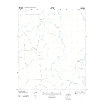
2011 Map of Line
USGS Topo · Published 2011About this map
Cutoff Creek meanders through the heart of this Ashley County landscape, defining a terrain shaped by its intricate waterways and low-lying wetlands. The map details a rural Arkansas environment where small settlements like Wolf Creek Camp and the community of Line sit among a dense network of county roads and drainage systems. For family historians, the presence of distinct burial sites such as Old Troy Cemetery, New Troy Cemetery, and Roper Cemetery provides specific geographic markers for tracing ancestral roots in the region. To the east, the Upper East WMA preserves the natural character of the bottomlands near Bayou Bartholomew, while the western portion of the sheet is crisscrossed by several prominent streams, including Stephens Creek and Bailey Creek.
Find a feature on this map
42 named features on this map. Tap any name to fly to it.
Don’t see what you’re looking for? This feature index may not catch every label — zoom into the map to look around manually.
Map Details
Editions of this 2011 Line Map
This is the sole edition of this map. No revisions or reprints were ever made.
Other maps of this area

1935 · Mist
USGS Topo · 1:62,500

1935 · Cominto
USGS Topo · 1:62,500

1936 · McGehee
USGS Topo · 1:62,500

1936 · Lake Village
USGS Topo · 1:62,500

1937 · McGehee
USGS Topo · 1:62,500

1953 · Greenwood
USGS Topo · 1:250,000

1955 · Lake Village
USGS Topo · 1:62,500

1955 · McGehee
USGS Topo · 1:62,500

1956 · Greenwood
USGS Topo · 1:250,000

1960 · Snyder
USGS Topo · 1:24,000