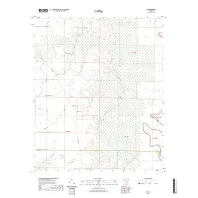
2020 Map of Line
USGS Topo · Published 2020About this map
Bayou Bartholomew snakes along the eastern edge of this landscape, marking the transition from the forested bottomlands to the diverse creek systems of Ashley and Drew counties. The geography is defined by a dense network of water, including Cutoff Creek, Stephens Cr, and Wolf Cr, which create a complex drainage pattern across the region. Local history is anchored by several rural burial grounds, including the Old Troy Cem and New Troy Cem, which sit near the intersection of several local routes like Co Rd 51. Further east, the terrain near Townsend Lake and the adjacent Townsend Cem provides a focal point for genealogical research in this sparsely settled area. The map illustrates a landscape primarily shaped by timber and water, with established timber paths like the Lower Gates Mainline and Water Trail cutting through the dense vegetation.
Find a feature on this map
47 named features on this map. Tap any name to fly to it.
Don’t see what you’re looking for? This feature index may not catch every label — zoom into the map to look around manually.
Map Details
Editions of this 2020 Line Map
This is the sole edition of this map. No revisions or reprints were ever made.
Other maps of this area

1935 · Mist
USGS Topo · 1:62,500

1935 · Cominto
USGS Topo · 1:62,500

1936 · McGehee
USGS Topo · 1:62,500

1936 · Lake Village
USGS Topo · 1:62,500

1937 · McGehee
USGS Topo · 1:62,500

1953 · Greenwood
USGS Topo · 1:250,000

1955 · Lake Village
USGS Topo · 1:62,500

1955 · McGehee
USGS Topo · 1:62,500

1956 · Greenwood
USGS Topo · 1:250,000

1960 · Snyder
USGS Topo · 1:24,000