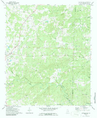
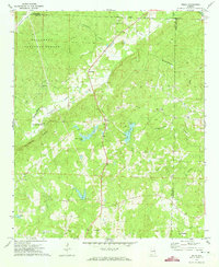
1970 Map of Lineville East
USGS Topo · Published 1986About this map
Lineville serves as the western anchor of this East Alabama landscape, where the rural topography is defined by the winding course of Crooked Creek and its many tributaries. The area reflects a deeply established community of country churches and family burial grounds, including Colemans Chapel, New Harmony Ch, and the Old Pleasant Grove Cem. The Seaboard Coast Line railroad cuts a significant path through the southern half of the quadrangle, passing through Berwick and nearing Cragford as it follows the drainage of the Tallapoosa River. Local industry is represented by a Gravel Pit near the river, while the presence of a Radio Tower and Sewage Disposal facility near Lineville indicates the mid-century modernization of this Piedmont region. This survey captures a moment when small rural settlements like Barfield remained distinct centers of local life before further regional consolidation.
Find a feature on this map
36 named features on this map. Tap any name to fly to it.
Don’t see what you’re looking for? This feature index may not catch every label — zoom into the map to look around manually.
Map Details
Editions of this 1970 Lineville East Map
2 editions found
Other maps of this area

1891 · Ashland
USGS Topo · 1:125,000

1953 · Atlanta
USGS Topo · 1:250,000

1957 · Atlanta
USGS Topo · 1:250,000

1958 · Atlanta
USGS Topo · 1:250,000

1969 · Wadley North
USGS Topo · 1:24,000

1969 · Gibsonville
USGS Topo · 1:24,000

1969 · Mellow Valley
USGS Topo · 1:24,000
1969 · Cheaha Mountain
USGS Topo · 1:24,000
1969 · Lineville West
USGS Topo · 1:24,000
1970 · Delta
USGS Topo · 1:24,000