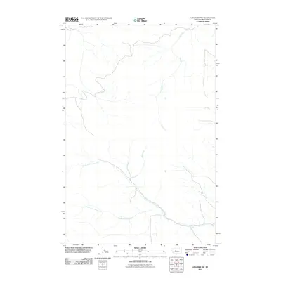
2011 Map of Lingshire NW
USGS Topo · Published 2011About this map
Sheep Creek forms a central drainage through this Meagher County landscape, where the high-plains terrain is deeply carved by a network of watercourses. The hydrology of the region is defined by the convergence of the North Fork Freeman Creek and South Fork Freeman Creek, which merge into Freeman Creek in the southeastern portion of the map. This 2011 survey by the U.S. Geological Survey illustrates a sparsely populated ranching territory where local landmarks like Mowing Machine Coulee and Trout Creek delineate the topography. The map provides a detailed view of the natural water distribution and drainage patterns necessary for land management in this part of Montana, showing how the smaller tributaries like Two Creek feed into the larger creek systems.
Find a feature on this map
13 named features on this map. Tap any name to fly to it.
Don’t see what you’re looking for? This feature index may not catch every label — zoom into the map to look around manually.
Map Details
Editions of this 2011 Lingshire NW Map
This is the sole edition of this map. No revisions or reprints were ever made.
Other maps of this area

1886 · Great Falls
USGS Topo · 1:250,000

1886 · Fort Logan
USGS Topo · 1:250,000

1948 · White Sulphur Springs
USGS Topo · 1:250,000

1954 · Great Falls
USGS Topo · 1:250,000

1957 · Great Falls
USGS Topo · 1:250,000

1958 · White Sulphur Springs
USGS Topo · 1:250,000

1961 · White Sulphur Springs
USGS Topo · 1:250,000

1961 · Dana Ranch
USGS Topo · 1:24,000

1962 · B K Ranch
USGS Topo · 1:24,000

1962 · Snedaker Basin
USGS Topo · 1:24,000