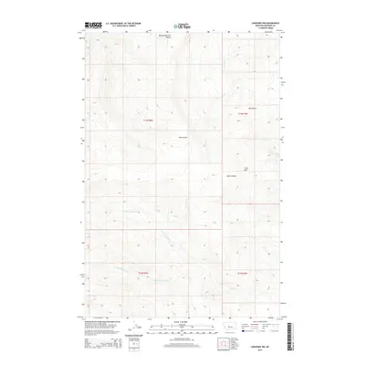
2014 Map of Lingshire NW
USGS Topo · Published 2014About this map
N Fork Freeman Cr and S Fork Freeman Cr define the drainage patterns of this sparsely settled section of Meagher County. The landscape is characterized by a series of dramatic geographic depressions and watercourses, most notably the deep cut of Black Canyon and the curiously named Mowing Machine Coulee. To the north, Whitetail Cr and Trout Cr flow through the high-elevation terrain, while Pine Coulee and Mud Gulch mark the central and eastern sections of the quadrangle. The lack of named settlements or infrastructure suggests a primary land use of open-range grazing or forestry, with the natural topography dictated by features like Cals Gulch and Freeman Cr. Researchers can observe the intricate contour lines that represent the varied elevations between the different coulees and gulches that dominate this remote part of Montana.
Find a feature on this map
15 named features on this map. Tap any name to fly to it.
Don’t see what you’re looking for? This feature index may not catch every label — zoom into the map to look around manually.
Map Details
Editions of this 2014 Lingshire NW Map
This is the sole edition of this map. No revisions or reprints were ever made.
Other maps of this area

1886 · Great Falls
USGS Topo · 1:250,000

1886 · Fort Logan
USGS Topo · 1:250,000

1948 · White Sulphur Springs
USGS Topo · 1:250,000

1954 · Great Falls
USGS Topo · 1:250,000

1957 · Great Falls
USGS Topo · 1:250,000

1958 · White Sulphur Springs
USGS Topo · 1:250,000

1961 · White Sulphur Springs
USGS Topo · 1:250,000

1961 · Dana Ranch
USGS Topo · 1:24,000

1962 · B K Ranch
USGS Topo · 1:24,000

1962 · Snedaker Basin
USGS Topo · 1:24,000