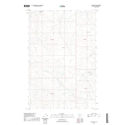
2020 Map of Lingshire NW
USGS Topo · Published 2020About this map
Black Canyon and a network of deep drainages define this remote portion of Meagher County, where the landscape is sculpted by seasonal waterways and steep topographical relief. The northern reaches are marked by Mowing Machine Coulee and Mud Gulch, while the southern terrain is dominated by the confluence of the N Fork Freeman Cr and the S Fork Freeman Cr. Human activity is sparse, centered primarily around Sky Ranch Rd in the southeastern quadrant, which provides access into the complex drainage systems. The map illustrates a high-elevation backcountry environment where water sources like Whitetail Cr and Trout Cr dictate the natural corridors through the varied terrain of Pine Coulee and Cals Gulch.
Find a feature on this map
17 named features on this map. Tap any name to fly to it.
Don’t see what you’re looking for? This feature index may not catch every label — zoom into the map to look around manually.
Map Details
Editions of this 2020 Lingshire NW Map
This is the sole edition of this map. No revisions or reprints were ever made.
Other maps of this area

1886 · Great Falls
USGS Topo · 1:250,000

1886 · Fort Logan
USGS Topo · 1:250,000

1948 · White Sulphur Springs
USGS Topo · 1:250,000

1954 · Great Falls
USGS Topo · 1:250,000

1957 · Great Falls
USGS Topo · 1:250,000

1958 · White Sulphur Springs
USGS Topo · 1:250,000

1961 · White Sulphur Springs
USGS Topo · 1:250,000

1961 · Dana Ranch
USGS Topo · 1:24,000

1962 · B K Ranch
USGS Topo · 1:24,000

1962 · Snedaker Basin
USGS Topo · 1:24,000