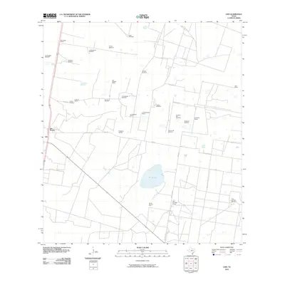
2010 Map of Linn
USGS Topo · Published 2010About this map
Sal del Ray, a natural salt lake, dominates the landscape of this South Texas region, where ranching and energy extraction define the local economy. The area around San Manuel and Linn is characterized by an extensive network of family-named ranches and windmills, reflecting the vital importance of groundwater management in this arid environment. Key sites include the San Felipe Ranch, El Rucio Ranch, and Tres Corrales Ranch, interspersed with infrastructure such as the San Manuel Gas Field and Sal del Rey Gas Field. Local history is anchored at the El Rucio Cemetery, while a system of named routes like Chapa Rd and El Rucio Rd connect the scattered homesteads and windmills that populate the territory north of the Rio Grande Valley.
Find a feature on this map
31 named features on this map. Tap any name to fly to it.
Don’t see what you’re looking for? This feature index may not catch every label — zoom into the map to look around manually.
Map Details
Editions of this 2010 Linn Map
This is the sole edition of this map. No revisions or reprints were ever made.
Other maps of this area

1922 · La Sal Vieja
USGS Topo · 1:62,500

1939 · Linn
USGS Topo · 1:62,500

1949 · Mc Allen
USGS Topo · 1:250,000

1953 · Brownsville
USGS Topo · 1:250,000

1954 · McAllen
USGS Topo · 1:250,000

1956 · Andrea Ranch
USGS Topo · 1:24,000

1956 · La Sal Vieja
USGS Topo · 1:24,000

1956 · La Sal Vieja
USGS Topo · 1:62,500

1956 · Brownsville
USGS Topo · 1:250,000

1956 · Port Isabel
USGS Topo · 1:250,000