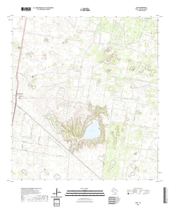
2022 Map of Linn
USGS Topo · Published 2022About this map
The settlement of San Manuel serves as a focal point for this survey of the South Texas brush country. This landscape is defined by the significant geological feature of Sal Del Ray, a natural salt lake that has been a vital resource in the region for centuries. The local heritage of the area is anchored by the San Manuel Cem and El Rucio Cem, which provide essential touchpoints for genealogical research in Hidalgo County.
Find a feature on this map
20 named features on this map. Tap any name to fly to it.
Don’t see what you’re looking for? This feature index may not catch every label — zoom into the map to look around manually.
Map Details
Editions of this 2022 Linn Map
This is the sole edition of this map. No revisions or reprints were ever made.
Other maps of this area

1922 · La Sal Vieja
USGS Topo · 1:62,500

1939 · Linn
USGS Topo · 1:62,500

1949 · Mc Allen
USGS Topo · 1:250,000

1953 · Brownsville
USGS Topo · 1:250,000

1954 · McAllen
USGS Topo · 1:250,000

1956 · Andrea Ranch
USGS Topo · 1:24,000

1956 · La Sal Vieja
USGS Topo · 1:24,000

1956 · La Sal Vieja
USGS Topo · 1:62,500

1956 · Brownsville
USGS Topo · 1:250,000

1956 · Port Isabel
USGS Topo · 1:250,000