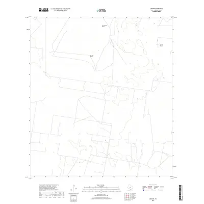
2019 Map of Linn NW
USGS Topo · Published 2019About this map
Tres Lagunas Pasture defines the northern reaches of this landscape in Hidalgo County, representing the traditional land divisions common in the ranching country of the Rio Grande Valley. The terrain is characterized by a network of intermittent wetlands and scattered depressions, suggesting the seasonal hydrology that dictated the use of these large grazing tracts. To the east and south, Santa Fe Pasture and San Juan Pasture mark significant territory within what was historically part of the Los Indios Ranch region. The sparse distribution of man-made structures and the prominence of named pastures highlight a rural economy still deeply tied to expansive cattle operations and original land grants in South Texas.
Find a feature on this map
3 named features on this map. Tap any name to fly to it.
Don’t see what you’re looking for? This feature index may not catch every label — zoom into the map to look around manually.
Map Details
Editions of this 2019 Linn NW Map
This is the sole edition of this map. No revisions or reprints were ever made.
Other maps of this area

1939 · Linn
USGS Topo · 1:62,500

1939 · La Reforma
USGS Topo · 1:62,500

1939 · Encantada
USGS Topo · 1:62,500

1949 · Mc Allen
USGS Topo · 1:250,000

1954 · McAllen
USGS Topo · 1:250,000

1957 · Mc Allen
USGS Topo · 1:250,000

1962 · McAllen
USGS Topo · 1:250,000
1963 · Callo Padrones
USGS Topo · 1:24,000

1963 · Linn NW
USGS Topo · 1:24,000
1963 · Linn Siding
USGS Topo · 1:24,000