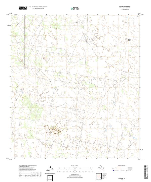
2022 Map of Linn NW
USGS Topo · Published 2022About this map
Tres Lagunas Pasture and the surrounding rangelands in northern Hidalgo County define this rural landscape. This territory is characterized by large, named land tracts such as San Juan Pasture and Santa Fe Pasture, which reflect the historic ranching patterns of the Deep South Texas brush country. Unlike more developed regions, this area is defined by its vast open spaces and ephemeral water features, with little in the way of permanent road infrastructure or municipal development. The elevation contours recorded by the U.S. Geological Survey show a subtle topography typical of the Rio Grande Valley hinterlands, where land use is dictated by the availability of pasture and seasonal ponds.
Find a feature on this map
3 named features on this map. Tap any name to fly to it.
Don’t see what you’re looking for? This feature index may not catch every label — zoom into the map to look around manually.
Map Details
Editions of this 2022 Linn NW Map
This is the sole edition of this map. No revisions or reprints were ever made.
Other maps of this area

1939 · Linn
USGS Topo · 1:62,500

1939 · La Reforma
USGS Topo · 1:62,500

1939 · Encantada
USGS Topo · 1:62,500

1949 · Mc Allen
USGS Topo · 1:250,000

1954 · McAllen
USGS Topo · 1:250,000

1957 · Mc Allen
USGS Topo · 1:250,000

1962 · McAllen
USGS Topo · 1:250,000
1963 · Callo Padrones
USGS Topo · 1:24,000

1963 · Linn NW
USGS Topo · 1:24,000
1963 · Linn Siding
USGS Topo · 1:24,000