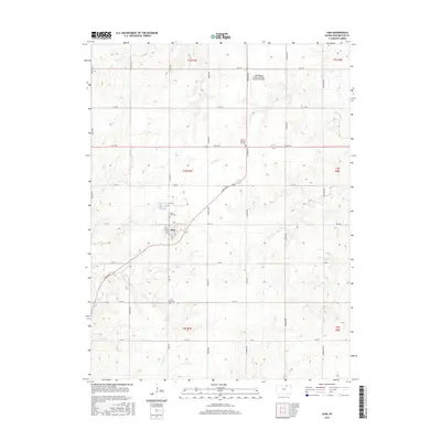
2015 Map of Linn
USGS Topo · Published 2015About this map
Linn serves as the central hub of this north-central Kansas landscape, where the town's grid meets a network of section-line roads like Osage Rd and Prairie Rd. The geography is defined by the drainage patterns of Coon Creek and Ash Creek, which carve gentle relief into the agricultural plains. For genealogists and local historians, several burial grounds are recorded across the townships, including Zion Cem, Saint Paul Cem, and the Linn City Cem. To the north, the Washington County Veteran's Memorial Airport represents a modern addition to the rural infrastructure, while District Number 17 Cem preserves an older community link in the northeast quadrant. The map detail highlights the persistent intersection of pioneer-era settlement patterns and contemporary aviation and transportation needs.
Find a feature on this map
32 named features on this map. Tap any name to fly to it.
Don’t see what you’re looking for? This feature index may not catch every label — zoom into the map to look around manually.
Map Details
Editions of this 2015 Linn Map
This is the sole edition of this map. No revisions or reprints were ever made.
Other maps of this area

1889 · Marysville
USGS Topo · 1:125,000

1893 · Washington
USGS Topo · 1:125,000

1894 · Marysville
USGS Topo · 1:125,000

1955 · Manhattan
USGS Topo · 1:250,000

1956 · Manhattan
USGS Topo · 1:250,000

1957 · Manhattan
USGS Topo · 1:250,000

1966 · Morrowville
USGS Topo · 1:24,000

1966 · Washington
USGS Topo · 1:24,000

1966 · Hanover SW
USGS Topo · 1:24,000
1968 · Linn SW
USGS Topo · 1:24,000