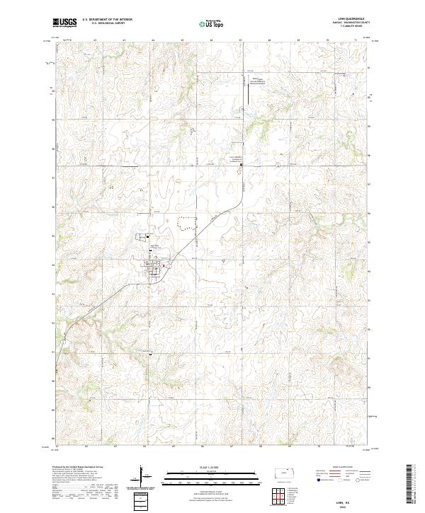
2022 Map of Linn
USGS Topo · Published 2022About this map
The agricultural community of Linn serves as the central hub for this portion of Washington County, defined by its grid of local roads and religious heritage. The map documents several significant burial grounds that reflect the area's denominational history, including Saint Pauls Lutheran Cem, Zion Cem, and the Saint Johannes Evangelical Lutheran Cem located further north along Quivira Rd. Transportation in the region is anchored by a network of section-line roads such as Osage Rd and Prairie Rd, while the Washington County Veteran's Memorial Airport sits at the northern edge near 12th Rd. The landscape is etched by small seasonal waterways including Ash Cr, Coon Cr, and Carter Cr, which drain the surrounding farmland. Modern landmarks like Lohmeyer Farms sit alongside the municipal Linn City Cem, illustrating the continuous land use in this Kansas prairie township.
Find a feature on this map
36 named features on this map. Tap any name to fly to it.
Don’t see what you’re looking for? This feature index may not catch every label — zoom into the map to look around manually.
Map Details
Editions of this 2022 Linn Map
This is the sole edition of this map. No revisions or reprints were ever made.
Other maps of this area

1889 · Marysville
USGS Topo · 1:125,000

1893 · Washington
USGS Topo · 1:125,000

1894 · Marysville
USGS Topo · 1:125,000

1955 · Manhattan
USGS Topo · 1:250,000

1956 · Manhattan
USGS Topo · 1:250,000

1957 · Manhattan
USGS Topo · 1:250,000

1966 · Morrowville
USGS Topo · 1:24,000

1966 · Washington
USGS Topo · 1:24,000

1966 · Hanover SW
USGS Topo · 1:24,000
1968 · Linn SW
USGS Topo · 1:24,000