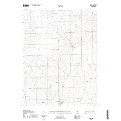
2017 Map of Linneus
USGS Topo · Published 2017About this map
Linneus and Purdin anchor this portion of Linn County, Missouri, situated within a landscape defined by the branching tributaries of Locust Creek. The terrain is marked by a high density of rural roads and drainage networks, including W Locust Cr, Muddy Cr, and Turkey Cr. For local historians and genealogists, the map identifies several smaller burial sites such as Gooch Cem, Southerland Cem, and Dryden Cem, which remain as persistent landmarks of the area's early settlement families. Significant water features such as the Linneus Reservoir and Number 217 Reservoir provide insight into the township's modern water management and local geography, while the intricate system of named branches like Kemper Br and Linn Br illustrates the natural drainage patterns into the larger creek systems.
Find a feature on this map
80 named features on this map. Tap any name to fly to it.
Don’t see what you’re looking for? This feature index may not catch every label — zoom into the map to look around manually.
Map Details
Editions of this 2017 Linneus Map
This is the sole edition of this map. No revisions or reprints were ever made.
Other maps of this area

1924 · Chula
USGS Topo · 1:62,500

1946 · Brookfield
USGS Topo · 1:62,500

1946 · Galt
USGS Topo · 1:62,500

1947 · Chula
USGS Topo · 1:62,500

1948 · Brookfield
USGS Topo · 1:62,500

1949 · Galt
USGS Topo · 1:62,500

1953 · Moberly
USGS Topo · 1:250,000

1954 · Centerville
USGS Topo · 1:250,000

1954 · Moberly
USGS Topo · 1:250,000

1957 · Moberly
USGS Topo · 1:250,000