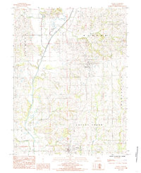
1984 Map of Linneus
USGS Topo · Published 1985About this map
Linneus and the surrounding township of Locust Creek are documented here in the early 1980s, revealing a landscape defined by its intricate drainage network. The area is dominated by the broad valley of West Locust Creek, which transitions into the main branch of Locust Creek as it flows south toward the county seat. The settlement of Purdin stands to the north, situated among the undulating terrain between Lowes Branch and the creek bottomlands.
Find a feature on this map
18 named features on this map. Tap any name to fly to it.
Don’t see what you’re looking for? This feature index may not catch every label — zoom into the map to look around manually.
Map Details
Editions of this 1984 Linneus Map
This is the sole edition of this map. No revisions or reprints were ever made.
Other maps of this area

1924 · Chula
USGS Topo · 1:62,500

1946 · Brookfield
USGS Topo · 1:62,500

1946 · Galt
USGS Topo · 1:62,500

1947 · Chula
USGS Topo · 1:62,500

1948 · Brookfield
USGS Topo · 1:62,500

1949 · Galt
USGS Topo · 1:62,500

1953 · Moberly
USGS Topo · 1:250,000

1954 · Centerville
USGS Topo · 1:250,000

1954 · Moberly
USGS Topo · 1:250,000

1957 · Moberly
USGS Topo · 1:250,000