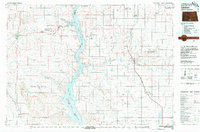
1980 Map of Linton
USGS Topo · Published 1980About this map
Lake Oahe dominates the central landscape of this 1980 survey, where the Missouri River corridor serves as the boundary for several historic jurisdictions. To the west, the Standing Rock Indian Reservation encompasses high ground such as the Porcupine Hills and settlements like Selfridge and Fort Yates. The eastern portion of the map is defined by the agricultural prairies surrounding Linton and Strasburg, connected by the Chicago Milwaukee St Paul and Pacific railroad line. Significant water conservation efforts are visible through the Sunburst Lake National Wildlife Refuge and numerous sloughs like Schumacher Slough. The map also preserves the Fort Rice Military Reservation Boundary and smaller communities such as Westfield and Hague near the southern border, documenting the late 20th-century rural infrastructure and transportation networks of Emmons, Morton, and Sioux counties.
Find a feature on this map
81 named features on this map. Tap any name to fly to it.
Don’t see what you’re looking for? This feature index may not catch every label — zoom into the map to look around manually.
Map Details
Editions of this 1980 Linton Map
This is the sole edition of this map. No revisions or reprints were ever made.
Other maps of this area

1907 · Bismarck
USGS Topo · 1:125,000

1953 · Jamestown
USGS Topo · 1:250,000

1953 · McIntosh
USGS Topo · 1:250,000

1954 · Aberdeen
USGS Topo · 1:250,000

1954 · Bismarck
USGS Topo · 1:250,000

1956 · Aberdeen
USGS Topo · 1:250,000

1956 · Jamestown
USGS Topo · 1:250,000

1958 · Bismarck
USGS Topo · 1:250,000

1958 · McIntosh
USGS Topo · 1:250,000

1965 · Herreid NW
USGS Topo · 1:24,000