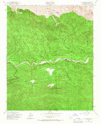
1943 Map of Lion Canyon
USGS Topo · Published 1966About this map
Los Padres National Forest dominates this mid-century survey, revealing a landscape defined by deep drainages and high lookout points during the World War II era. The terrain is anchored by the massive ridge of Pine Mountain to the north, which transitions into the intricate watershed of Sespe Creek. Settlement is sparse and focused on remote outposts like Pine Mountain Lodge and private holdings such as Circle B Ranch and Rancho Grande.
Find a feature on this map
20 named features on this map. Tap any name to fly to it.
Don’t see what you’re looking for? This feature index may not catch every label — zoom into the map to look around manually.
Map Details
Editions of this 1943 Lion Canyon Map
4 editions found
Other maps of this area

1903 · Santa Paula
USGS Topo · 1:62,500

1903 · Mt. Pinos
USGS Topo · 1:125,000

1904 · Ventura
USGS Topo · 1:62,500

1941 · Ventura
USGS Topo · 1:62,500

1942 · Santa Paula
USGS Topo · 1:62,500

1942 · Wheeler Springs
USGS Topo · 1:24,000

1943 · Topatopa Mountains
USGS Topo · 1:24,000

1943 · San Guillermo
USGS Topo · 1:24,000

1943 · Lockwood Valley
USGS Topo · 1:24,000

1943 · Lion Canyon
USGS Topo · 1:24,000