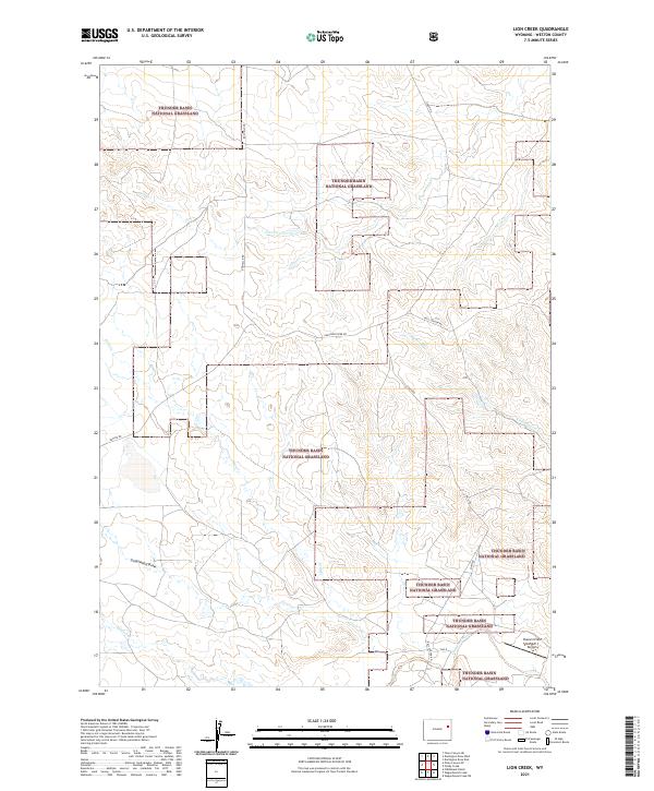
2021 Map of Lion Creek
USGS Topo · Published 2021About this map
Thunder Basin National Grassland dominates this portion of Weston County, where a network of seasonal watercourses defines the open high-plains landscape. The Cheyenne River winds through the central territory, joined by tributaries like Cottonwood Cr and Lion Cr. This area is characterized by large-scale public land management interspersed with private sections, a pattern reflected in the township and range boundaries of t42n r68w and t41n r67w. Transportation is facilitated by long-distance rural routes such as Rochelle Rd and Cheyenne River Rd, which serve the remote ranching and energy-producing interior. Near the southern edge, the Sherwin Field Number 1 Airport provides a critical aviation link for this sparsely populated region, while Underwood Draw and Keyton Cr mark the western drainages.
Find a feature on this map
20 named features on this map. Tap any name to fly to it.
Don’t see what you’re looking for? This feature index may not catch every label — zoom into the map to look around manually.
Map Details
Editions of this 2021 Lion Creek Map
This is the sole edition of this map. No revisions or reprints were ever made.
Other maps of this area

1955 · Newcastle
USGS Topo · 1:250,000

1958 · Newcastle
USGS Topo · 1:250,000

1971 · Fiddleback Ranch
USGS Topo · 1:24,000

1971 · Piney Canyon NE
USGS Topo · 1:24,000

1971 · Piney Canyon SE
USGS Topo · 1:24,000

1974 · Reno Junction
USGS Topo · 1:100,000

1979 · Newcastle
USGS Topo · 1:100,000

1979 · Bill
USGS Topo · 1:100,000
1981 · Wagonhound Creek
USGS Topo · 1:24,000

1981 · Wagonhound Creek NE
USGS Topo · 1:24,000