
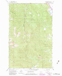
1962 Map of Lion Mountain
USGS Topo · Published 1964About this map
Lion Mountain dominates this portion of the Flathead National Forest, standing as a central landmark in a landscape defined by sharp elevation changes and high-altitude drainages. In the early 1960s, this area remained largely undeveloped, characterized by a complex network of seasonal watercourses and primitive access routes. The survey reveals several prominent peaks, including Baldy Mountain and Blacktail Mountain, which overlook the headwaters of numerous creeks that flow toward the valley floor. Notable among these are Stoner Creek and Bierney Creek, which trace winding paths through the timbered terrain. A single Pack Trail serves as a primary corridor through the forest, emphasizing the remote nature of the territory. In the northeastern corner, the Great Northern rail line and the waters of Birch Creek provide the only major industrial and hydrological landmarks, marking the boundary where the wilderness meets more established transport routes.
Find a feature on this map
16 named features on this map. Tap any name to fly to it.
Don’t see what you’re looking for? This feature index may not catch every label — zoom into the map to look around manually.
Map Details
Editions of this 1962 Lion Mountain Map
2 editions found
Other maps of this area

1920 · Flathead Lake
USGS Topo · 1:125,000

1943 · Kalispell
USGS Topo · 1:125,000

1956 · Wallace
USGS Topo · 1:250,000

1957 · Kalispell
USGS Topo · 1:250,000

1960 · Kalispell
USGS Topo · 1:250,000

1960 · Wallace
USGS Topo · 1:250,000

1961 · Kalispell
USGS Topo · 1:250,000

1962 · Kila
USGS Topo · 1:24,000

1962 · Blue Grass Ridge
USGS Topo · 1:24,000

1962 · Somers
USGS Topo · 1:24,000