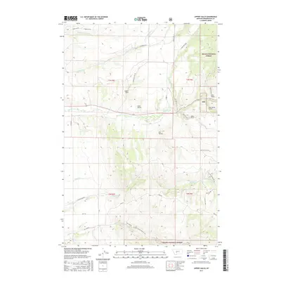
2017 Map of Lippert Gulch
USGS Topo · Published 2017About this map
Helena National Forest dominates the eastern and southern edges of this landscape, framing a series of drainage systems that descend from the high ground toward the west. The area around Lippert Gulch and Flume Hollow reveals a network of canyons and gulches, including Ross Gulch and Black Butte Gulch, which have shaped the local movement of water and travel. The presence of Flathead Indian Trail Rd along the eastern edge of Greyson Cr suggests a long-standing corridor of passage through these hills.
Find a feature on this map
37 named features on this map. Tap any name to fly to it.
Don’t see what you’re looking for? This feature index may not catch every label — zoom into the map to look around manually.
Map Details
Editions of this 2017 Lippert Gulch Map
This is the sole edition of this map. No revisions or reprints were ever made.
Other maps of this area

1886 · Fort Logan
USGS Topo · 1:250,000

1948 · White Sulphur Springs
USGS Topo · 1:250,000

1949 · Maudlow
USGS Topo · 1:62,500

1949 · Toston
USGS Topo · 1:62,500

1950 · Duck Creek Pass
USGS Topo · 1:62,500

1958 · White Sulphur Springs
USGS Topo · 1:250,000

1961 · White Sulphur Springs
USGS Topo · 1:250,000

1965 · White Sulphur Springs
USGS Topo · 1:250,000
1971 · Mount Edith
USGS Topo · 1:24,000
1971 · Sulphur Bar Creek
USGS Topo · 1:24,000