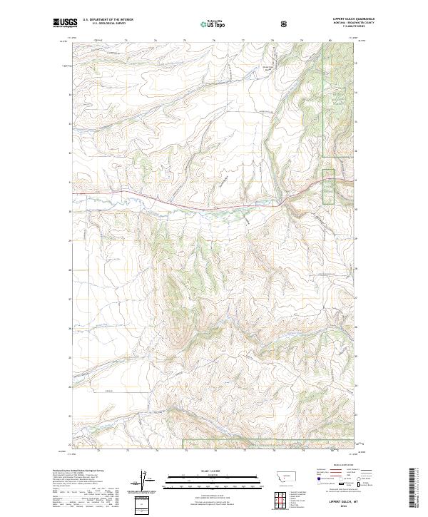
2024 Map of Lippert Gulch
USGS Topo · Published 2024About this map
Deep Creek and its many tributaries, including North Fork Deep Creek and Boone Run, carve through this section of the Big Belt Mountains. The landscape is defined by the transition from ranching and agricultural valley floors to the protected slopes of the Helena National Forest. Small-scale aviation is represented by the Clover Crest Airpark in the northern section, while the drainage systems of Greyson Creek and Dry Creek dictate the local road network. The map reveals a network of gulches and hollows, such as Lippert Gulch and Flume Hollow, which have long influenced water management and land use in this part of Broadwater County. These named features illustrate the complex topography that governs movement between the higher forest elevations and the creek valleys below.
Find a feature on this map
34 named features on this map. Tap any name to fly to it.
Don’t see what you’re looking for? This feature index may not catch every label — zoom into the map to look around manually.
Map Details
Editions of this 2024 Lippert Gulch Map
This is the sole edition of this map. No revisions or reprints were ever made.
Other maps of this area

1886 · Fort Logan
USGS Topo · 1:250,000

1948 · White Sulphur Springs
USGS Topo · 1:250,000

1949 · Maudlow
USGS Topo · 1:62,500

1949 · Toston
USGS Topo · 1:62,500

1950 · Duck Creek Pass
USGS Topo · 1:62,500

1958 · White Sulphur Springs
USGS Topo · 1:250,000

1961 · White Sulphur Springs
USGS Topo · 1:250,000

1965 · White Sulphur Springs
USGS Topo · 1:250,000
1971 · Mount Edith
USGS Topo · 1:24,000
1971 · Sulphur Bar Creek
USGS Topo · 1:24,000