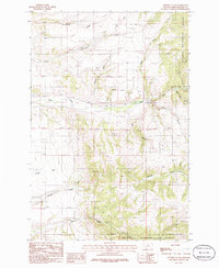
1986 Map of Lippert Gulch
USGS Topo · Published 1986About this map
Helena National Forest dominates the eastern landscape of this Broadwater County region, where the terrain transitions from high ridges down into the drainages of the Big Belt Mountains. The settlement of Boone sits along the western edge of the quadrangle, serving as a landmark near the open valley floor. Water management is a visible priority in this environment, evidenced by the technical infrastructure of a Siphon and Flume near Lippert Gulch and Deep Creek, components of a landscape adapted for transport and irrigation.
Find a feature on this map
20 named features on this map. Tap any name to fly to it.
Don’t see what you’re looking for? This feature index may not catch every label — zoom into the map to look around manually.
Map Details
Editions of this 1986 Lippert Gulch Map
This is the sole edition of this map. No revisions or reprints were ever made.
Other maps of this area

1886 · Fort Logan
USGS Topo · 1:250,000

1948 · White Sulphur Springs
USGS Topo · 1:250,000

1949 · Maudlow
USGS Topo · 1:62,500

1949 · Toston
USGS Topo · 1:62,500

1950 · Duck Creek Pass
USGS Topo · 1:62,500

1958 · White Sulphur Springs
USGS Topo · 1:250,000

1961 · White Sulphur Springs
USGS Topo · 1:250,000

1965 · White Sulphur Springs
USGS Topo · 1:250,000
1971 · Mount Edith
USGS Topo · 1:24,000
1971 · Sulphur Bar Creek
USGS Topo · 1:24,000