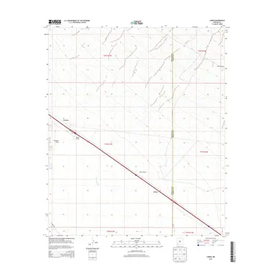
2013 Map of Lisbon
USGS Topo · Published 2013About this map
The arid corridor of the Lordsburg Valley dominates this 2013 survey of southwestern New Mexico, where the infrastructure of modern transit cuts across a landscape shaped by intermittent drainage. The settlement of Lisbon sits at the intersection of a major highway and the Hidalgo County-Grant County line, while the rail-side location of Ulmoris serves as a secondary waypoint in the northwest. The terrain is defined by dramatic changes in elevation where Walker Canyon and Jones Canyon descend into the flatlands. This map captures the region's hydrography through the Burro Cienaga, a critical water system in the high desert that dictates local ranching and land use patterns across several townships, including t23s r17w and t24s r17w.
Find a feature on this map
15 named features on this map. Tap any name to fly to it.
Don’t see what you’re looking for? This feature index may not catch every label — zoom into the map to look around manually.
Map Details
Editions of this 2013 Lisbon Map
This is the sole edition of this map. No revisions or reprints were ever made.
Other maps of this area

1954 · Silver City
USGS Topo · 1:250,000

1958 · Silver City
USGS Topo · 1:250,000

1962 · Silver City
USGS Topo · 1:250,000

1962 · Ninetysix Ranch
USGS Topo · 1:24,000

1962 · Lisbon
USGS Topo · 1:24,000

1963 · Lordsburg
USGS Topo · 1:24,000

1963 · Gold Hill
USGS Topo · 1:24,000

1963 · Culberson Ranch
USGS Topo · 1:24,000
1963 · C Bar Ranch
USGS Topo · 1:24,000

1964 · Muir Ranch
USGS Topo · 1:24,000