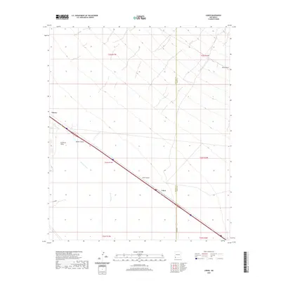
2020 Map of Lisbon
USGS Topo · Published 2020About this map
Lordsburg Valley dominates this high-desert landscape in southwestern New Mexico, where the infrastructure of modern transit follows historical paths through the Hidalgo and Grant County borderlands. The settlement of Lisbon sits alongside the primary transportation corridor that cuts diagonally across the quadrangle, passing through the arid expanse near Ulmoris. The terrain is defined by drainage patterns like Burro Cienaga and the seasonal watercourses of Walker Canyon and Jones Canyon, which carve through the high plains. This 2020 survey documents the intersection of rural county roads such as Co Rd B001 and Co Rd B002 with the major regional thoroughfare, illustrating how modern logistics continue to rely on these specific gaps in the desert topography first utilized by early settlers and railroads.
Find a feature on this map
15 named features on this map. Tap any name to fly to it.
Don’t see what you’re looking for? This feature index may not catch every label — zoom into the map to look around manually.
Map Details
Editions of this 2020 Lisbon Map
This is the sole edition of this map. No revisions or reprints were ever made.
Other maps of this area

1954 · Silver City
USGS Topo · 1:250,000

1958 · Silver City
USGS Topo · 1:250,000

1962 · Silver City
USGS Topo · 1:250,000

1962 · Ninetysix Ranch
USGS Topo · 1:24,000

1962 · Lisbon
USGS Topo · 1:24,000

1963 · Lordsburg
USGS Topo · 1:24,000

1963 · Gold Hill
USGS Topo · 1:24,000

1963 · Culberson Ranch
USGS Topo · 1:24,000
1963 · C Bar Ranch
USGS Topo · 1:24,000

1964 · Muir Ranch
USGS Topo · 1:24,000