
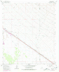
1962 Map of Lisbon
USGS Topo · Published 1978About this map
Butterfield Trail tracks across the arid New Mexico landscape, marking a historical corridor for mail and passenger transport long before modern infrastructure arrived. This 1962 survey of the high desert focuses on the transportation and utility network northwest of the Southern Pacific line. The small rail-side settlement of Lisbon and the nearby Ulmoris station anchor the map, surrounded by isolated infrastructure like the Lordsburg Pumping Sta and several pipelines. Water sources are scarce, appearing as seasonal drainages such as Burro Cienaga, Engineer Canyon, and Walker Canyon. The presence of the Mesquite Windmill and North Lisbon Windmill highlights the vital role of groundwater for ranching in this territory. Genealogists and historians can also trace the Old Railroad Grade in the southwest corner, alongside the Hidalgo and Grant county line.
Find a feature on this map
19 named features on this map. Tap any name to fly to it.
Don’t see what you’re looking for? This feature index may not catch every label — zoom into the map to look around manually.
Map Details
Editions of this 1962 Lisbon Map
2 editions found
Other maps of this area

1954 · Silver City
USGS Topo · 1:250,000

1958 · Silver City
USGS Topo · 1:250,000

1962 · Silver City
USGS Topo · 1:250,000

1962 · Ninetysix Ranch
USGS Topo · 1:24,000

1963 · Lordsburg
USGS Topo · 1:24,000

1963 · Gold Hill
USGS Topo · 1:24,000

1963 · Culberson Ranch
USGS Topo · 1:24,000
1963 · C Bar Ranch
USGS Topo · 1:24,000

1964 · Muir Ranch
USGS Topo · 1:24,000

1964 · Pyramid Peak
USGS Topo · 1:24,000