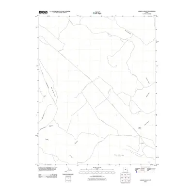
2010 Map of Lisbon Valley
USGS Topo · Published 2010About this map
Big Indian Valley and the surrounding high desert plateau dominate this 2010 geographic study of southeastern Utah. The landscape is defined by the intersection of industrial activity and topographical landmarks, where Lisbon Valley Rd and Big Indian Rd provide access to remote resource extraction sites. Mineral exploration is centered at the Louise Mine in the west and the Cub Mine to the southeast, illustrating the persistent mining economy of San Juan County.
Find a feature on this map
23 named features on this map. Tap any name to fly to it.
Don’t see what you’re looking for? This feature index may not catch every label — zoom into the map to look around manually.
Map Details
Editions of this 2010 Lisbon Valley Map
This is the sole edition of this map. No revisions or reprints were ever made.
Other maps of this area

1885 · La Sal
USGS Topo · 1:250,000

1954 · Mt Peale 1 SE
USGS Topo · 1:24,000

1954 · Mt Peale 4 NE
USGS Topo · 1:24,000

1954 · Mt Peale 4 NW
USGS Topo · 1:24,000

1954 · Mt Peale 3 NE
USGS Topo · 1:24,000

1954 · Mt Peale 3 SE
USGS Topo · 1:24,000

1954 · Mt Peale 1 SW
USGS Topo · 1:24,000
1954 · Mt Peale 4 SE
USGS Topo · 1:24,000

1954 · Mt Peale 2 SE
USGS Topo · 1:24,000

1954 · Mt Peale 4 SW
USGS Topo · 1:24,000