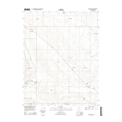
2014 Map of Lisbon Valley
USGS Topo · Published 2014About this map
Lisbon Valley defines the core of this landscape in San Juan County, revealing a network of remote corridors and geographic landmarks as they existed in the early 2010s. The topographic detail highlights the corridor along W Summit Rd and the access point at Wilson Shaft Rd, which points to the area's industrial history. Distinctive formations such as Big Indian Rock and Mid Mesa provide orientation within the vast high-desert terrain. Water sources, vital for navigation and historic land use in this arid region, are mapped at Lisbon Spring and Huntley Spring. The map further distinguishes between the wider Big Indian Valley and the more confined Lower Lisbon Valley, offering a precise record of drainage patterns and ranch-road connectivity through Little Valley and across Three Step Hill.
Find a feature on this map
28 named features on this map. Tap any name to fly to it.
Don’t see what you’re looking for? This feature index may not catch every label — zoom into the map to look around manually.
Map Details
Editions of this 2014 Lisbon Valley Map
This is the sole edition of this map. No revisions or reprints were ever made.
Other maps of this area

1885 · La Sal
USGS Topo · 1:250,000

1954 · Mt Peale 1 SE
USGS Topo · 1:24,000

1954 · Mt Peale 4 NE
USGS Topo · 1:24,000

1954 · Mt Peale 4 NW
USGS Topo · 1:24,000

1954 · Mt Peale 3 NE
USGS Topo · 1:24,000

1954 · Mt Peale 3 SE
USGS Topo · 1:24,000

1954 · Mt Peale 1 SW
USGS Topo · 1:24,000
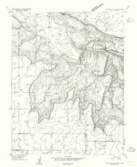
1954 · Mt Peale 4 SE
USGS Topo · 1:24,000

1954 · Mt Peale 2 SE
USGS Topo · 1:24,000

1954 · Mt Peale 4 SW
USGS Topo · 1:24,000