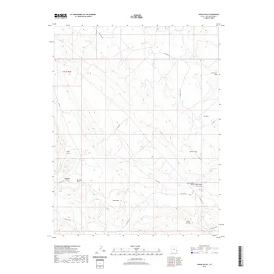
2020 Map of Lisbon Valley
USGS Topo · Published 2020About this map
Big Indian Rock serves as a prominent landmark in this corner of San Juan County, overlooking the broad expanse of Big Indian Valley. The landscape is defined by the significant drainage systems of East Coyote Wash and Bullhorn Wash, which carve through the high desert terrain. Local geography is further marked by the transition from Mid Mesa down into the depths of Lisbon Canyon and Spiller Canyon.
Find a feature on this map
23 named features on this map. Tap any name to fly to it.
Don’t see what you’re looking for? This feature index may not catch every label — zoom into the map to look around manually.
Map Details
Editions of this 2020 Lisbon Valley Map
This is the sole edition of this map. No revisions or reprints were ever made.
Other maps of this area

1885 · La Sal
USGS Topo · 1:250,000

1954 · Mt Peale 1 SE
USGS Topo · 1:24,000

1954 · Mt Peale 4 NE
USGS Topo · 1:24,000

1954 · Mt Peale 4 NW
USGS Topo · 1:24,000

1954 · Mt Peale 3 NE
USGS Topo · 1:24,000

1954 · Mt Peale 3 SE
USGS Topo · 1:24,000

1954 · Mt Peale 1 SW
USGS Topo · 1:24,000
1954 · Mt Peale 4 SE
USGS Topo · 1:24,000

1954 · Mt Peale 2 SE
USGS Topo · 1:24,000

1954 · Mt Peale 4 SW
USGS Topo · 1:24,000