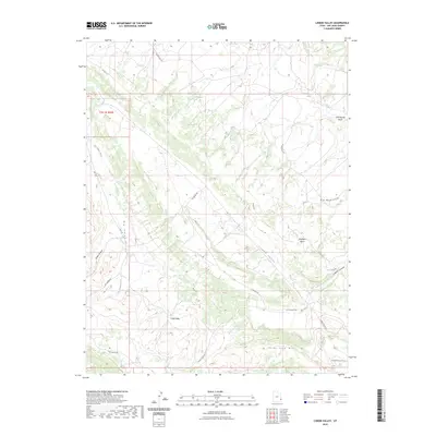
2023 Map of Lisbon Valley
USGS Topo · Published 2023About this map
Lisbon Valley and Big Indian Valley define the landscape of this high-desert region in San Juan County, Utah. The topography is marked by a series of northwest-trending valleys separated by dramatic rises such as Mid Mesa and Three Step Hill. Surface water is scarce in this arid environment, represented by intermittent drainages like Big Indian Wash, Bullhorn Wash, and East Coyote Wash. Permanent water sources are limited to a few specific points including Lisbon Spring and Huntley Spring. The road network consists primarily of county and ranch access routes, such as Lisbon Valley Rd, Little Valley Rd, and Patterson Ranch Rd, indicating a landscape largely shaped by ranching interests and natural resource access. Steep elevation changes are evident in Spiller Canyon and Lisbon Canyon, illustrating the complex geological folding common to this part of the Colorado Plateau.
Find a feature on this map
21 named features on this map. Tap any name to fly to it.
Don’t see what you’re looking for? This feature index may not catch every label — zoom into the map to look around manually.
Map Details
Editions of this 2023 Lisbon Valley Map
This is the sole edition of this map. No revisions or reprints were ever made.
Other maps of this area

1885 · La Sal
USGS Topo · 1:250,000

1954 · Mt Peale 1 SE
USGS Topo · 1:24,000

1954 · Mt Peale 4 NE
USGS Topo · 1:24,000

1954 · Mt Peale 4 NW
USGS Topo · 1:24,000

1954 · Mt Peale 3 NE
USGS Topo · 1:24,000

1954 · Mt Peale 3 SE
USGS Topo · 1:24,000

1954 · Mt Peale 1 SW
USGS Topo · 1:24,000
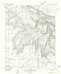
1954 · Mt Peale 4 SE
USGS Topo · 1:24,000

1954 · Mt Peale 2 SE
USGS Topo · 1:24,000

1954 · Mt Peale 4 SW
USGS Topo · 1:24,000