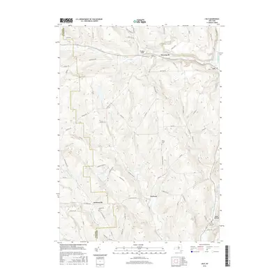
2016 Map of Lisle
USGS Topo · Published 2016About this map
The Tioughnioga River corridor defines the eastern edge of this landscape, where the village of Lisle sits at the confluence of several drainages. The terrain is characterized by a series of high ridges and narrow valleys, such as those housing Dudley Creek and Nanticoke Creek. This network of upland roads, including Clute Hill Rd and Edwards Hill Rd, connects a series of historic hamlets and agricultural crossroads like Center Lisle, Manningville, and Ketchumville.
Find a feature on this map
71 named features on this map. Tap any name to fly to it.
Don’t see what you’re looking for? This feature index may not catch every label — zoom into the map to look around manually.
Map Details
Editions of this 2016 Lisle Map
This is the sole edition of this map. No revisions or reprints were ever made.
Other maps of this area

1901 · Apalachin
USGS Topo · 1:62,500

1903 · Harford
USGS Topo · 1:62,500

1904 · Binghamton
USGS Topo · 1:62,500

1904 · Greene
USGS Topo · 1:62,500

1904 · Apalachin
USGS Topo · 1:62,500

1906 · Catatonk
USGS Topo · 1:125,000

1934 · Castle Creek
USGS Topo · 1:24,000

1942 · Castle Creek
USGS Topo · 1:31,680

1948 · Binghamton
USGS Topo · 1:250,000
1949 · Whitney Point
USGS Topo · 1:24,000