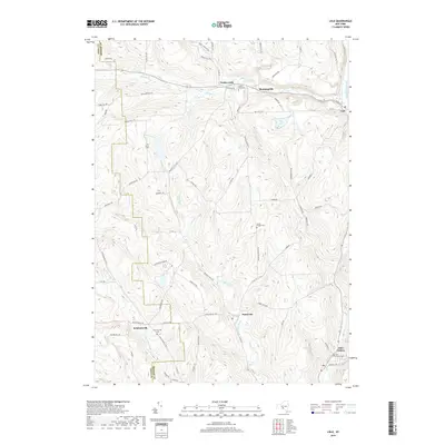
2019 Map of Lisle
USGS Topo · Published 2019About this map
Center Lisle and the surrounding valley communities sit at the junction of several drainage systems in Broome and Tioga Counties. The landscape is defined by the winding course of Dudley Creek as it flows toward its confluence with the Tioughnioga River near the village of Lisle. To the south, the terrain becomes more complex as Nanticoke Cr and Ketchumville Br carve through the hills near Nanticoke.
Find a feature on this map
72 named features on this map. Tap any name to fly to it.
Don’t see what you’re looking for? This feature index may not catch every label — zoom into the map to look around manually.
Map Details
Editions of this 2019 Lisle Map
This is the sole edition of this map. No revisions or reprints were ever made.
Other maps of this area

1901 · Apalachin
USGS Topo · 1:62,500

1903 · Harford
USGS Topo · 1:62,500

1904 · Binghamton
USGS Topo · 1:62,500

1904 · Greene
USGS Topo · 1:62,500

1904 · Apalachin
USGS Topo · 1:62,500

1906 · Catatonk
USGS Topo · 1:125,000

1934 · Castle Creek
USGS Topo · 1:24,000

1942 · Castle Creek
USGS Topo · 1:31,680

1948 · Binghamton
USGS Topo · 1:250,000
1949 · Whitney Point
USGS Topo · 1:24,000