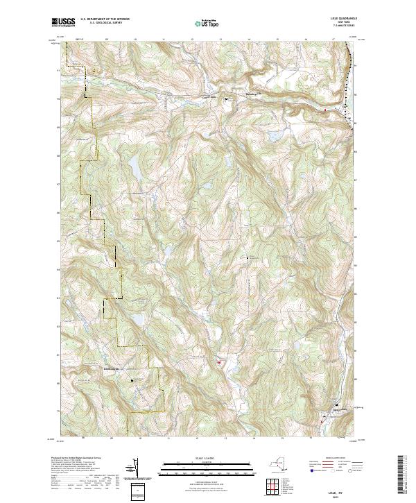
2023 Map of Lisle
USGS Topo · Published 2023About this map
The rolling highlands of Broome County are defined by a series of steep ridges and creek valleys, where small settlements have persisted for generations. Lisle sits in the northeast corner along Dudley Creek, while the western portion of the map is shaped by the Tioga Co and Broome Co boundary line. This border cuts through a landscape marked by family-named landmarks like Popple Hill Rd and Briggs Hill Rd, reflecting a long history of upland farming and rural life. In the southern reaches, Ketchumville and Glen Aubrey serve as local hubs, each anchored by their respective burial grounds, the Ketchumville Cem and Glen Aubrey Cem. The drainage patterns of Nanticoke Creek and its Ketchumville Branch illustrate the area's complex topography, which rises toward the prominent peak of Mount Hunger. Local genealogy is well-represented through numerous hillside cemeteries, including the Mount Hunger Cem and Center Lisle Cem, which offer significant research value for tracing residents of these historic hamlets.
Find a feature on this map
69 named features on this map. Tap any name to fly to it.
Don’t see what you’re looking for? This feature index may not catch every label — zoom into the map to look around manually.
Map Details
Editions of this 2023 Lisle Map
This is the sole edition of this map. No revisions or reprints were ever made.
Other maps of this area

1901 · Apalachin
USGS Topo · 1:62,500

1903 · Harford
USGS Topo · 1:62,500

1904 · Binghamton
USGS Topo · 1:62,500

1904 · Greene
USGS Topo · 1:62,500

1904 · Apalachin
USGS Topo · 1:62,500

1906 · Catatonk
USGS Topo · 1:125,000

1934 · Castle Creek
USGS Topo · 1:24,000

1942 · Castle Creek
USGS Topo · 1:31,680

1948 · Binghamton
USGS Topo · 1:250,000
1949 · Whitney Point
USGS Topo · 1:24,000