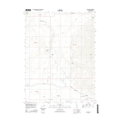
2015 Map of Litchfield
USGS Topo · Published 2015About this map
Honey Lake Valley dominates the southern landscape of this Lassen County region, where the Susan River feeds a complex network of irrigation infrastructure. This 2015 survey details a working landscape defined by the Main Canal, Lower Canal, and Woodstock Canal, which serve the agricultural lands surrounding Litchfield. To the north, the terrain transitions from the valley floor into the high elevations of Shaffer Mtn and Tunnison Mtn. Small settlements like Belfast and The Crossing sit along established transit corridors such as Karlo Rd, while numerous family-named landmarks like Wards Lake and Morgan Spring provide points of reference for local historians. The map also documents the seasonal drainage patterns of Willow Cr and Petes Cr as they flow toward the valley basin.
Find a feature on this map
40 named features on this map. Tap any name to fly to it.
Don’t see what you’re looking for? This feature index may not catch every label — zoom into the map to look around manually.
Map Details
Editions of this 2015 Litchfield Map
This is the sole edition of this map. No revisions or reprints were ever made.
Other maps of this area

1886 · Honey Lake
USGS Topo · 1:250,000

1891 · Honey Lake
USGS Topo · 1:250,000

1893 · Honey Lake
USGS Topo · 1:250,000

1954 · Susanville
USGS Topo · 1:62,500

1954 · Litchfield
USGS Topo · 1:62,500

1954 · Karlo
USGS Topo · 1:62,500

1954 · Fredonyer Peak
USGS Topo · 1:62,500

1955 · Westwood
USGS Topo · 1:250,000

1958 · Westwood
USGS Topo · 1:250,000

1959 · Westwood
USGS Topo · 1:250,000