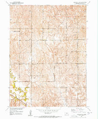
1951 Map of Litchfield NE
USGS Topo · Published 1953About this map
Sherman County rural life in the early 1950s is defined by a dense network of one-room schoolhouses scattered across the prairie. The landscape is organized by township boundaries like Elm Webster and Harrison Clay, where local education once centered on sites like Tucker Sch and Fairview Sch. To the south, the terrain descends toward the valley of Mud Creek, where the Chicago Burlington and Quincy railroad cuts a diagonal path through the township of Scott Hazard. This 1951 field-checked survey preserves the exact locations of numerous Windmills, essential infrastructure for the upland farms. Near the winding course of Clear Creek, researchers can find Cedarville Sch and Little Gem Sch, marking a period before the consolidation of these small rural districts changed the Nebraska countryside forever.
Find a feature on this map
14 named features on this map. Tap any name to fly to it.
Don’t see what you’re looking for? This feature index may not catch every label — zoom into the map to look around manually.
Map Details
Editions of this 1951 Litchfield NE Map
3 editions found
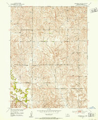
Other maps of this area

1899 · Loup
USGS Topo · 1:125,000

1951 · Arcadia SE
USGS Topo · 1:24,000

1951 · Litchfield SW
USGS Topo · 1:24,000

1951 · Litchfield NE
USGS Topo · 1:24,000

1951 · Hazard
USGS Topo · 1:24,000

1951 · Arcadia SW
USGS Topo · 1:24,000

1951 · Litchfield
USGS Topo · 1:24,000

1953 · Ravenna NW
USGS Topo · 1:24,000

1953 · Loup City
USGS Topo · 1:24,000

1953 · Ravenna
USGS Topo · 1:24,000