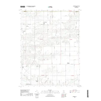
2018 Map of Literberry
USGS Topo · Published 2018About this map
Literberry and Arcadia anchor this agricultural landscape in northern Morgan County, where the terrain transitions from the upland plains into the dissected drainages of Indian Cr and Snake Cr. The settlement pattern is defined by a dense grid of country roads, many bearing legacy names like Literberry Prentice Rd and Literberry Triopia Rd, which reflect the historical connectivity between small Illinois farming hubs. For genealogists, the map is particularly rich in burial sites, documenting locations such as Henderson-McFadden Cem, Oak Ridge Cem, and the Hazel Green Cem near Portuguese Hill. Along the southern margin, the northern edge of Jacksonville appears, including the Jacksonville Municipal Airport. The eastern edge is marked by the sharp relief of Cavanaugh Bluff, overlooking the seasonal waters of Conover Br as they feed toward the Illinois River watershed.
Find a feature on this map
81 named features on this map. Tap any name to fly to it.
Don’t see what you’re looking for? This feature index may not catch every label — zoom into the map to look around manually.
Map Details
Editions of this 2018 Literberry Map
This is the sole edition of this map. No revisions or reprints were ever made.
Other maps of this area

1924 · Winchester
USGS Topo · 1:48,000

1926 · Winchester
USGS Topo · 1:62,500

1929 · Arenzville
USGS Topo · 1:62,500

1932 · Arenzville
USGS Topo · 1:62,500

1932 · Jacksonville
USGS Topo · 1:62,500

1932 · Virginia
USGS Topo · 1:62,500

1936 · Virginia
USGS Topo · 1:62,500

1937 · Jacksonville
USGS Topo · 1:62,500

1948 · Quincy
USGS Topo · 1:250,000

1956 · Quincy
USGS Topo · 1:250,000