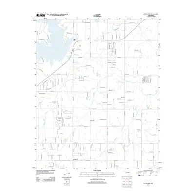
2012 Map of Little Axe
USGS Topo · Published 2012About this map
Lake Thunderbird dominates the northwestern corner of this landscape, its irregular shoreline reaching toward the community of Little Axe. This area of Cleveland County is defined by a dense network of residential roads and rural routes, such as Alameda St and 180th Ave NE, which weave between the numerous tributaries of the Little River. Small settlements and historic gathering points are scattered throughout, including Needmore and Etowah to the south.
Find a feature on this map
159 named features on this map. Tap any name to fly to it.
Don’t see what you’re looking for? This feature index may not catch every label — zoom into the map to look around manually.
Map Details
Editions of this 2012 Little Axe Map
This is the sole edition of this map. No revisions or reprints were ever made.
Other maps of this area

1892 · Moore
USGS Topo · 1:62,500

1893 · Norman
USGS Topo · 1:62,500

1898 · Purcell
USGS Topo · 1:125,000

1910 · McComb
USGS Topo · 1:62,500

1930 · McLoud
USGS Topo · 1:62,500

1934 · Moore
USGS Topo · 1:62,500

1936 · Norman
USGS Topo · 1:62,500

1938 · Moore
USGS Topo · 1:62,500

1954 · Oklahoma City
USGS Topo · 1:250,000
1956 · Franklin
USGS Topo · 1:24,000