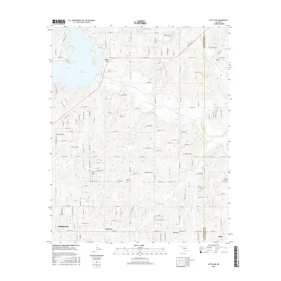
2016 Map of Little Axe
USGS Topo · Published 2016About this map
Lake Thunderbird and its eastern shoreline define the northwestern corner of this landscape, where the Little River State Park meets a network of country roads. The area is characterized by scattered rural settlements such as Little Axe, Slaughterville, and Etowah, which are linked by historic routes like Alameda St and Little Axe Dr. The terrain is etched by several watercourses, including Roulette Cr and Spring Cr, which flow toward the Little River valley.
Find a feature on this map
137 named features on this map. Tap any name to fly to it.
Don’t see what you’re looking for? This feature index may not catch every label — zoom into the map to look around manually.
Map Details
Editions of this 2016 Little Axe Map
This is the sole edition of this map. No revisions or reprints were ever made.
Other maps of this area

1892 · Moore
USGS Topo · 1:62,500

1893 · Norman
USGS Topo · 1:62,500

1898 · Purcell
USGS Topo · 1:125,000

1910 · McComb
USGS Topo · 1:62,500

1930 · McLoud
USGS Topo · 1:62,500

1934 · Moore
USGS Topo · 1:62,500

1936 · Norman
USGS Topo · 1:62,500

1938 · Moore
USGS Topo · 1:62,500

1954 · Oklahoma City
USGS Topo · 1:250,000
1956 · Franklin
USGS Topo · 1:24,000