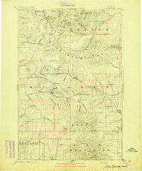
1894 Map of Little Belt Mts.
USGS Topo · Published 1894About this map
White Sulphur Spring serves as a primary hub in this late nineteenth-century mountain landscape, where the Little Belt Mountains meet the northern edge of the Crazy Mountains. This survey by the Northern Transcontinental Survey reflects an era of early central Montana settlement and resource discovery, particularly evident at the mining camp of Neihart and the settlement of Copperopolis. The map records a complex hydrological network including the headwaters of the Judith River and the Musselshell River, which supported early ranches and camps. Along the Shields River Guide Meridian, small settlements like Robinson, Grande, and Martinsdale are established near key water sources and the foothills of the Castle Mountains. Genealogists will find interest in the precise township and section lines that frame these early locales, documenting the region's transition from open range to a more formal land survey system.
Find a feature on this map
130 named features on this map. Tap any name to fly to it.
Don’t see what you’re looking for? This feature index may not catch every label — zoom into the map to look around manually.
Map Details
Editions of this 1894 Little Belt Mts. Map
2 editions found

Other maps of this area

1886 · Great Falls
USGS Topo · 1:250,000

1886 · Fort Logan
USGS Topo · 1:250,000

1886 · Little Belt Mts.
USGS Topo · 1:250,000

1888 · Three Forks
USGS Topo · 1:250,000

1889 · Big Snowy Mountain
USGS Topo · 1:250,000

1890 · Fort Benton
USGS Topo · 1:250,000

1891 · Livingston
USGS Topo · 1:250,000

1891 · Big Timber
USGS Topo · 1:125,000

1892 · Fort Benton
USGS Topo · 1:250,000

1893 · Livingston
USGS Topo · 1:250,000