
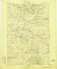
1894 Map of Little Belt Mts.
USGS Topo · Published 1894About this map
White Sulphur Spring serves as a central landmark in this 1894 landscape, where the Little Belt Mountains meet the Castle Mountains and the northern reach of the Crazy Mountains. This late nineteenth-century topography, based on work by the Northern Transcontinental Survey, illustrates a region defined by high-altitude mining interests and early cattle ranching. The presence of Copperopolis and the mining hub of Neihart reflects the era's mineral boom, while scattered settlements like Martinsdale and Utica anchor the river valleys. Waterways like the Smith River and Judith River carve through the complex terrain, connecting isolated outposts like Blackhawk and Robinson. The map captures the transition from a frontier territory to a structured state landscape, marked by county divisions including Meagher, Fergus, Gallatin, and Park.
Find a feature on this map
130 named features on this map. Tap any name to fly to it.
Don’t see what you’re looking for? This feature index may not catch every label — zoom into the map to look around manually.
Map Details
Editions of this 1894 Little Belt Mts. Map
2 editions found
Other maps of this area

1886 · Great Falls
USGS Topo · 1:250,000

1886 · Fort Logan
USGS Topo · 1:250,000

1886 · Little Belt Mts.
USGS Topo · 1:250,000

1888 · Three Forks
USGS Topo · 1:250,000

1889 · Big Snowy Mountain
USGS Topo · 1:250,000

1890 · Fort Benton
USGS Topo · 1:250,000

1891 · Livingston
USGS Topo · 1:250,000

1891 · Big Timber
USGS Topo · 1:125,000

1892 · Fort Benton
USGS Topo · 1:250,000

1893 · Livingston
USGS Topo · 1:250,000