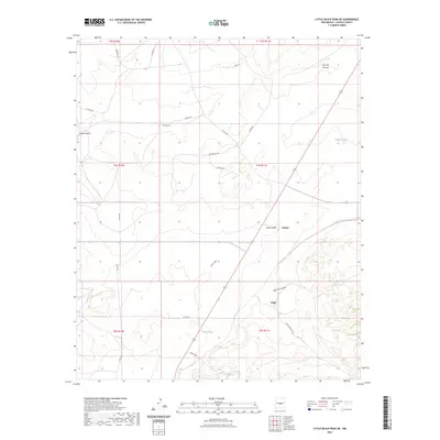
2023 Map of Little Black Peak NE
USGS Topo · Published 2023About this map
Ancho Valley and its surrounding drainages define this high-desert landscape in Lincoln County. The settlements of Cooper and Largo sit at the center of a complex network of local roads and cattle-range infrastructure, where vital water sources like Indian Spring and Killgore Tank supported the region's ranching economy. The map reveals a highly structured system of land management, marked by numerous named ranch roads including Ranchouse Rd, Straley Rd, and Sparkey Rd. Significant geographic features such as Red Hill Canyon, Largo Canyon, and Big Pine Canyon cut through the terrain, illustrating the natural watercourses that dictated the placement of early homesteads and modern tanks like Storey-Tank and Cathy Tank.
Find a feature on this map
32 named features on this map. Tap any name to fly to it.
Don’t see what you’re looking for? This feature index may not catch every label — zoom into the map to look around manually.
Map Details
Editions of this 2023 Little Black Peak NE Map
This is the sole edition of this map. No revisions or reprints were ever made.
Other maps of this area

1950 · Little Black Peak
USGS Topo · 1:62,500

1954 · Fort Sumner
USGS Topo · 1:250,000

1955 · Roswell
USGS Topo · 1:250,000

1958 · Fort Sumner
USGS Topo · 1:250,000

1958 · Roswell
USGS Topo · 1:250,000

1962 · Roswell
USGS Topo · 1:250,000

1973 · Ancho
USGS Topo · 1:24,000
1973 · White Oaks North
USGS Topo · 1:24,000

1980 · Corona
USGS Topo · 1:100,000
1981 · Polecat Draw
USGS Topo · 1:24,000