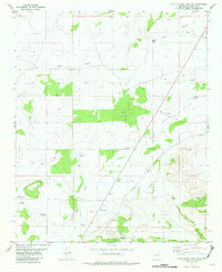
1981 Map of Little Black Peak NE
USGS Topo · Published 1982About this map
The Southern Pacific railroad cuts a diagonal line across this arid high-desert landscape in Lincoln County, anchoring the region's transport network during the early 1980s. The topography is defined by the broad Ancho Valley and its many tributary drainages, including Ancho Gulch and Largo Canyon. Water management is the primary sign of human activity here, with a dense network of catchment features such as Killgore Tank, Storey Tank, and Railroad Tank supporting livestock or steam-era rail infrastructure. Local landmarks like Red Hill and Big Pine Canyon provide navigational points in a terrain marked by scattered windmills and wells. The presence of the Roadside Park along the highway and various Gravel Pit sites suggests a landscape utilized for both regional transit and local material extraction.
Find a feature on this map
22 named features on this map. Tap any name to fly to it.
Don’t see what you’re looking for? This feature index may not catch every label — zoom into the map to look around manually.
Map Details
Editions of this 1981 Little Black Peak NE Map
This is the sole edition of this map. No revisions or reprints were ever made.
Other maps of this area

1950 · Little Black Peak
USGS Topo · 1:62,500

1954 · Fort Sumner
USGS Topo · 1:250,000

1955 · Roswell
USGS Topo · 1:250,000

1958 · Fort Sumner
USGS Topo · 1:250,000

1958 · Roswell
USGS Topo · 1:250,000

1962 · Roswell
USGS Topo · 1:250,000

1973 · Ancho
USGS Topo · 1:24,000
1973 · White Oaks North
USGS Topo · 1:24,000

1980 · Corona
USGS Topo · 1:100,000
1981 · Polecat Draw
USGS Topo · 1:24,000