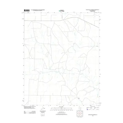
2012 Map of Little Blue Creek
USGS Topo · Published 2012About this map
Sneed Ranch sits within this expansive Panhandle landscape in Moore County, characterized by a complex drainage network that defines the local ranching environment. The topography is shaped by the convergence of several waterways, most notably Big Blue Cr and its tributaries, Little Blue Cr and Hay Cr. This drainage pattern illustrates the critical role of surface water management in this arid region, where ranching operations are tied closely to the natural flow of the creeks. Transportation across the plains is supported by dedicated corridors such as Texas Beef Rd and Road 22, which facilitate the movement of livestock and supplies. The presence of Ludlow Cr further complicates the drainage profile, showing how the land is naturally partitioned by these seasonal watercourses, providing a clear picture of the region's agricultural infrastructure in the early twenty-first century.
Find a feature on this map
7 named features on this map. Tap any name to fly to it.
Don’t see what you’re looking for? This feature index may not catch every label — zoom into the map to look around manually.
Map Details
Editions of this 2012 Little Blue Creek Map
This is the sole edition of this map. No revisions or reprints were ever made.
Other maps of this area

1936 · Fourways
USGS Topo · 1:62,500

1939 · Sanford
USGS Topo · 1:62,500

1953 · Evans Canyon
USGS Topo · 1:24,000

1953 · Masterson
USGS Topo · 1:24,000

1953 · Spencer Draw
USGS Topo · 1:24,000

1954 · Amarillo
USGS Topo · 1:250,000

1958 · Amarillo
USGS Topo · 1:250,000

1965 · Dumas South
USGS Topo · 1:24,000
1965 · Dumas North
USGS Topo · 1:24,000
1972 · Little Blue Creek
USGS Topo · 1:24,000