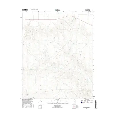
2016 Map of Little Blue Creek
USGS Topo · Published 2016About this map
The Moore County drainage basin is defined here by the confluence of several significant waterways, including Big Blue Cr and its tributaries. In this northern Texas landscape, the terrain is shaped by the winding paths of Little Blue Cr and Ludlow Cr, which carve through the plains. The map reflects a predominantly agricultural and ranching environment, indicated by the network of local connectors such as Texas Beef Rd and S Coon Rd. These roads facilitate movement across the open country, linking remote parcels to the regional infrastructure. The presence of Hay Cr in the southeastern corner further emphasizes the importance of water management and natural drainage in this part of the Panhandle. This survey provides a clear view of the land's topographical contours and the essential road network that supports the area's rural economy.
Find a feature on this map
8 named features on this map. Tap any name to fly to it.
Don’t see what you’re looking for? This feature index may not catch every label — zoom into the map to look around manually.
Map Details
Editions of this 2016 Little Blue Creek Map
This is the sole edition of this map. No revisions or reprints were ever made.
Other maps of this area

1936 · Fourways
USGS Topo · 1:62,500

1939 · Sanford
USGS Topo · 1:62,500

1953 · Evans Canyon
USGS Topo · 1:24,000

1953 · Masterson
USGS Topo · 1:24,000

1953 · Spencer Draw
USGS Topo · 1:24,000

1954 · Amarillo
USGS Topo · 1:250,000

1958 · Amarillo
USGS Topo · 1:250,000

1965 · Dumas South
USGS Topo · 1:24,000
1965 · Dumas North
USGS Topo · 1:24,000
1972 · Little Blue Creek
USGS Topo · 1:24,000