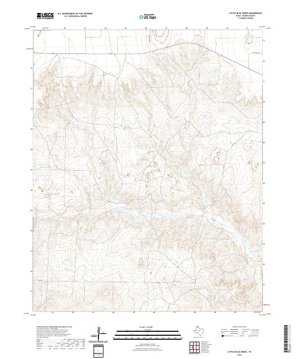
2022 Map of Little Blue Creek
USGS Topo · Published 2022About this map
Big Blue Cr and its tributaries define this Moore County landscape, cutting deep drainages through the high plains of the Texas Panhandle. The map reveals a land structured by water and ranch roads, where the confluence of Little Blue Cr and Hay Cr creates a significant topographic break. The drainage pattern of Ludlow Cr in the west further illustrates the erosional forces shaping this region. While much of the terrain is open, the transport network is anchored by State Hwy 152 crossing the northern section, connecting with local routes like Texas Reef Rd and White Rd. This 2022 survey serves as a modern baseline for the hydrologic and road systems of the Little Blue Creek area, documenting the exact layout of rural access points such as S Coon Rd and Rd 22 as they exist today.
Find a feature on this map
9 named features on this map. Tap any name to fly to it.
Don’t see what you’re looking for? This feature index may not catch every label — zoom into the map to look around manually.
Map Details
Editions of this 2022 Little Blue Creek Map
This is the sole edition of this map. No revisions or reprints were ever made.
Other maps of this area

1936 · Fourways
USGS Topo · 1:62,500

1939 · Sanford
USGS Topo · 1:62,500

1953 · Evans Canyon
USGS Topo · 1:24,000

1953 · Masterson
USGS Topo · 1:24,000

1953 · Spencer Draw
USGS Topo · 1:24,000

1954 · Amarillo
USGS Topo · 1:250,000

1958 · Amarillo
USGS Topo · 1:250,000

1965 · Dumas South
USGS Topo · 1:24,000
1965 · Dumas North
USGS Topo · 1:24,000
1972 · Little Blue Creek
USGS Topo · 1:24,000