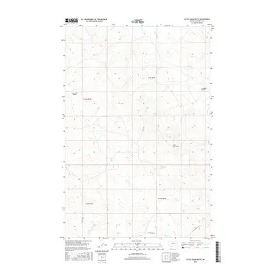
2017 Map of Little Chalk Butte
USGS Topo · Published 2017About this map
Little Chalk Butte rises as a distinct landmark in this high-plains landscape of Garfield County, marking a terrain defined by deep coulees and seasonal watercourses. The local drainage network is shaped by Crow Rock Cr, Ash Cr, and the branches of Uall Cr, which carve through the dry Montana rangeland. The presence of Coal Mine Coulee in the northeast suggests the region's underlying geological history, while the curiously named Frozen Dog Coulee adds a layer of local vernacular to the northwest section. Human activity is recorded primarily through a sparse network of section-line roads and tracks, including Uall Rd and Sutherland Rd, which connect remote ranching interests and water sources like Mud Springs. This 2017 survey provides a high-resolution view of the township and range divisions across this sparsely populated corner of the state.
Find a feature on this map
15 named features on this map. Tap any name to fly to it.
Don’t see what you’re looking for? This feature index may not catch every label — zoom into the map to look around manually.
Map Details
Editions of this 2017 Little Chalk Butte Map
This is the sole edition of this map. No revisions or reprints were ever made.
Other maps of this area

1954 · Jordan
USGS Topo · 1:250,000

1954 · Forsyth
USGS Topo · 1:250,000

1956 · Jordan
USGS Topo · 1:250,000

1957 · Forsyth
USGS Topo · 1:250,000

1958 · Jordan
USGS Topo · 1:250,000

1958 · Forsyth
USGS Topo · 1:250,000

1964 · Jordan
USGS Topo · 1:250,000

1965 · Rock Springs School
USGS Topo · 1:24,000

1965 · Little Chalk Butte
USGS Topo · 1:24,000

1965 · Hedstrom Lake SE
USGS Topo · 1:24,000