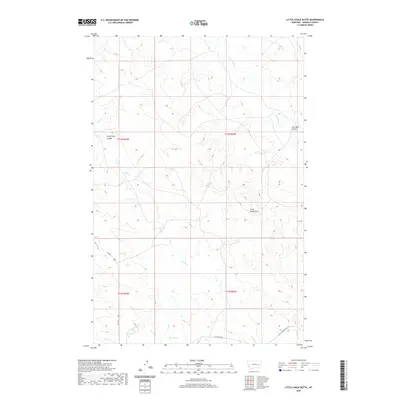
2020 Map of Little Chalk Butte
USGS Topo · Published 2020About this map
Little Chalk Butte rises as the central landmark in this Garfield County landscape, overlooking a network of deep drainage channels and water sources. The topography is defined by significant coulees that suggest a history of resource extraction and local nomenclature, such as Coal Mine Coulee and the uniquely named Frozen Dog Coulee. Water is a critical element in this arid environment, represented by the persistent flows of Uall Cr and its eastern branch, E Uall Cr, along with the localized Mud Springs.
Find a feature on this map
15 named features on this map. Tap any name to fly to it.
Don’t see what you’re looking for? This feature index may not catch every label — zoom into the map to look around manually.
Map Details
Editions of this 2020 Little Chalk Butte Map
This is the sole edition of this map. No revisions or reprints were ever made.
Other maps of this area

1954 · Jordan
USGS Topo · 1:250,000

1954 · Forsyth
USGS Topo · 1:250,000

1956 · Jordan
USGS Topo · 1:250,000

1957 · Forsyth
USGS Topo · 1:250,000

1958 · Jordan
USGS Topo · 1:250,000

1958 · Forsyth
USGS Topo · 1:250,000

1964 · Jordan
USGS Topo · 1:250,000

1965 · Rock Springs School
USGS Topo · 1:24,000

1965 · Little Chalk Butte
USGS Topo · 1:24,000

1965 · Hedstrom Lake SE
USGS Topo · 1:24,000