1978 Map of Little Chicago
USGS Topo · Published 1979About this map
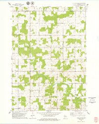
The borderlands of Lincoln and Marathon counties define this 1970s landscape, where small rural crossroads like Little Chicago and Naugart serve as focal points for a community of scattered farmsteads and field lines. The area is marked by a deep-rooted religious and civic infrastructure, evidenced by numerous country churches such as St Peters Ch and Zion Ch. A high density of burial grounds, including the unusual Rest Haven Pet Cem and the Rib View Cem, offers significant detail for genealogical research.
Find a feature on this map
34 named features on this map. Tap any name to fly to it.
Don’t see what you’re looking for? This feature index may not catch every label — zoom into the map to look around manually.
Map Details
Editions of this 1978 Little Chicago Map
2 editions found

Other maps of this area

1899 · Wausau
USGS Topo · 1:125,000

1902 · Wausau
USGS Topo · 1:125,000

1902 · Marathon
USGS Topo · 1:125,000
1951 · Merrill
USGS Topo · 1:48,000

1951 · Hamburg
USGS Topo · 1:48,000

1953 · Wausau
USGS Topo · 1:48,000

1953 · Marathon
USGS Topo · 1:48,000

1954 · Iron Mountain
USGS Topo · 1:250,000

1955 · Green Bay
USGS Topo · 1:250,000

1959 · Iron Mountain
USGS Topo · 1:250,000