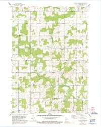
1978 Map of Little Chicago
USGS Topo · Published 1992About this map
The Little Chicago crossroads marks a central point in this late-1970s survey of rural Marathon County. This landscape is defined by the headwaters of the Little Rib River and its West Fork, where farming operations are interspersed with dense woodlots. The map reveals a deeply rooted German Lutheran heritage, evident in the cluster of country churches such as Trinity Ch and the Dreieinigkeit Conf church.
Find a feature on this map
34 named features on this map. Tap any name to fly to it.
Don’t see what you’re looking for? This feature index may not catch every label — zoom into the map to look around manually.
Map Details
Editions of this 1978 Little Chicago Map
2 editions found
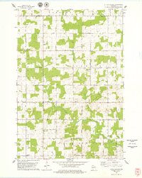
Other maps of this area

1899 · Wausau
USGS Topo · 1:125,000

1902 · Wausau
USGS Topo · 1:125,000

1902 · Marathon
USGS Topo · 1:125,000

1951 · Merrill
USGS Topo · 1:48,000

1951 · Hamburg
USGS Topo · 1:48,000

1953 · Wausau
USGS Topo · 1:48,000

1953 · Marathon
USGS Topo · 1:48,000

1954 · Iron Mountain
USGS Topo · 1:250,000

1955 · Green Bay
USGS Topo · 1:250,000

1959 · Iron Mountain
USGS Topo · 1:250,000