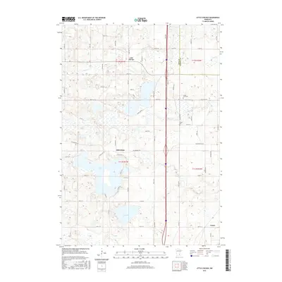
2016 Map of Little Chicago
USGS Topo · Published 2016About this map
Little Chicago and Millersburg anchor this landscape along the border of Rice and Dakota counties, where a glacial topography of lakes and winding creeks dictates the local road network. The settlement of Little Chicago sits near the headwaters of Knowles Cr, while to the south, Millersburg is positioned between the northern shores of Circle Lake and the wetlands of Wolf Cr. This 2016 survey illustrates the persistent rural character of the region, defined by long-established family farmstead roads like Hazelwood Ave and Bagley Ave. For genealogists and local historians, the map identifies specific community landmarks such as Rolling Green Cem near the eastern hills and Forest Cem tucked south of the glacial depression of Heath Cr. The map also captures the southeastern settlement of Comus and the significant water bodies of Union Lake and Fox Lake, which remain central to the area's geography.
Find a feature on this map
69 named features on this map. Tap any name to fly to it.
Don’t see what you’re looking for? This feature index may not catch every label — zoom into the map to look around manually.
Map Details
Editions of this 2016 Little Chicago Map
This is the sole edition of this map. No revisions or reprints were ever made.
Other maps of this area

1953 · Saint Paul
USGS Topo · 1:250,000

1957 · Farmington
USGS Topo · 1:62,500

1957 · Prior Lake
USGS Topo · 1:62,500

1959 · Saint Paul
USGS Topo · 1:250,000

1960 · Faribault
USGS Topo · 1:24,000

1960 · Northfield
USGS Topo · 1:24,000

1960 · Cannon City
USGS Topo · 1:24,000

1960 · Shieldsville
USGS Topo · 1:24,000

1960 · Lonsdale
USGS Topo · 1:24,000

1960 · Little Chicago
USGS Topo · 1:24,000